As gorgeous as British Columbia is, it should come as no surprise that the province is a hiker’s paradise. With its vast wilderness, stunning mountain ranges, and diverse landscapes, BC offers some of the best hiking trails in the world. Don’t worry if you’re not an avid hiker; both novices and experts can savor lush rainforests, while the more adventurous should not miss the more challenging climbs passing dense pine forests to the summit.
So grab your hiking boots, a backpack, and hit the trails! Here are nine of the best hiking trails in British Columbia, Canada that every outdoor enthusiast, from beginner to hiking guru, should add to their must-do list.
While you’re in B.C., you may as well do the full outdoor experience and do some glamping!
Best Hikes in Vancouver Island
West Coast Trail
- Location: Vancouver Island, from Port Renfrew to Bamfield
- Distance: 75 km (47 mi)
- Elevation gain: 5,000 m (16,400 ft)
- Difficulty: Challenging
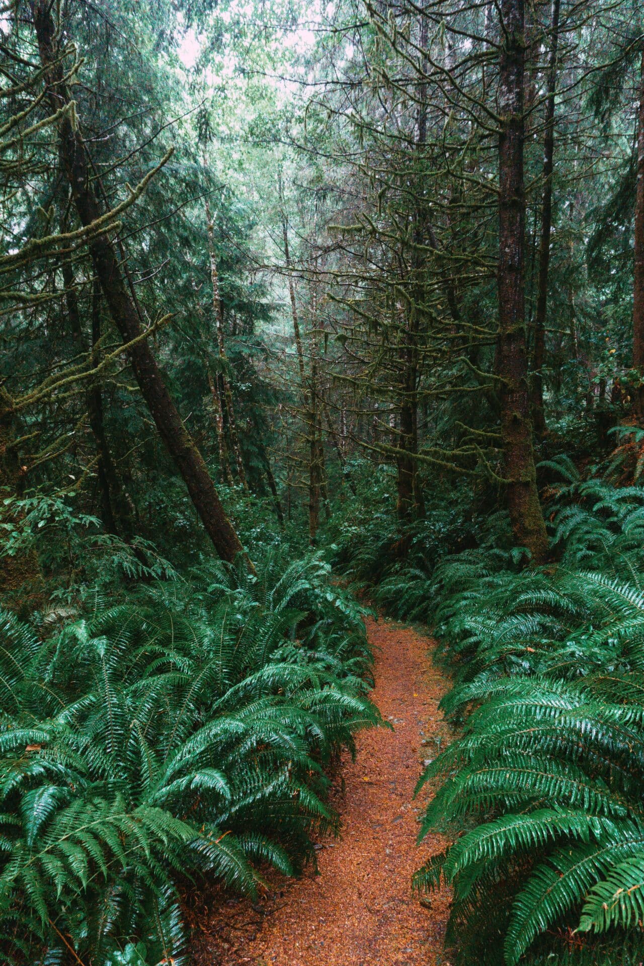
The West Coast Trail is one of the most challenging and rewarding hikes in Canada. For 75 kilometers (47 miles) it follows a rugged wilderness coastline that’s been shaped by glaciers, wind, and waves over thousands of years. With stunning views of the Pacific Ocean, hikers can spot gray whales, harbor seals, and sea lions along the way and even see the elusive Roosevelt elk. You’ll hike through old-growth rainforests with ladders and suspension bridges, making for an unforgettable experience.
The trail is challenging but well-marked, with steep climbs and descents, but the rewards are great. There are a number of campsites along the way, making it a great option for a multi-day backpacking trip.
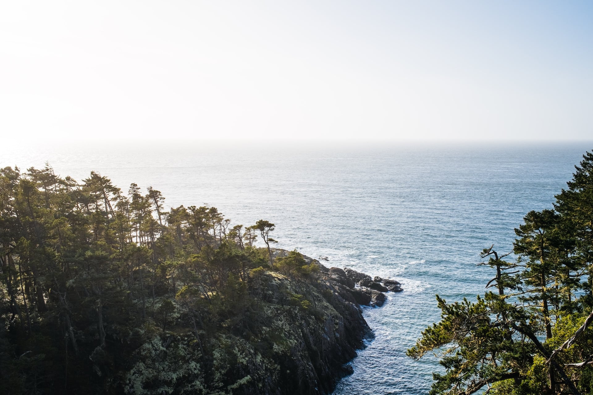
Juan de Fuca Marine Trail
- Location: Juan de Fuca Provincial Park, Vancouver Island
- Distance: 47 km (29 mi)
- Elevation gain: 1,500 m (4,921 ft)
- Difficulty: Moderate
The Juan de Fuca Marine Trail is another great coastal trail for hikers looking for a challenging and rewarding experience, with wonderful views of the Olympic Mountains. This 47-kilometre (29-mile) trail follows the rugged coastline of Vancouver Island, from Victoria to Port Renfrew. The trail is well-marked and maintained, but it’s important to be prepared for challenging terrain and variable weather conditions. There are plenty of opportunities to see wildlife, including whales, sea lions, and seals. This trail is suitable for older kids.
Mainland British Columbia Trails
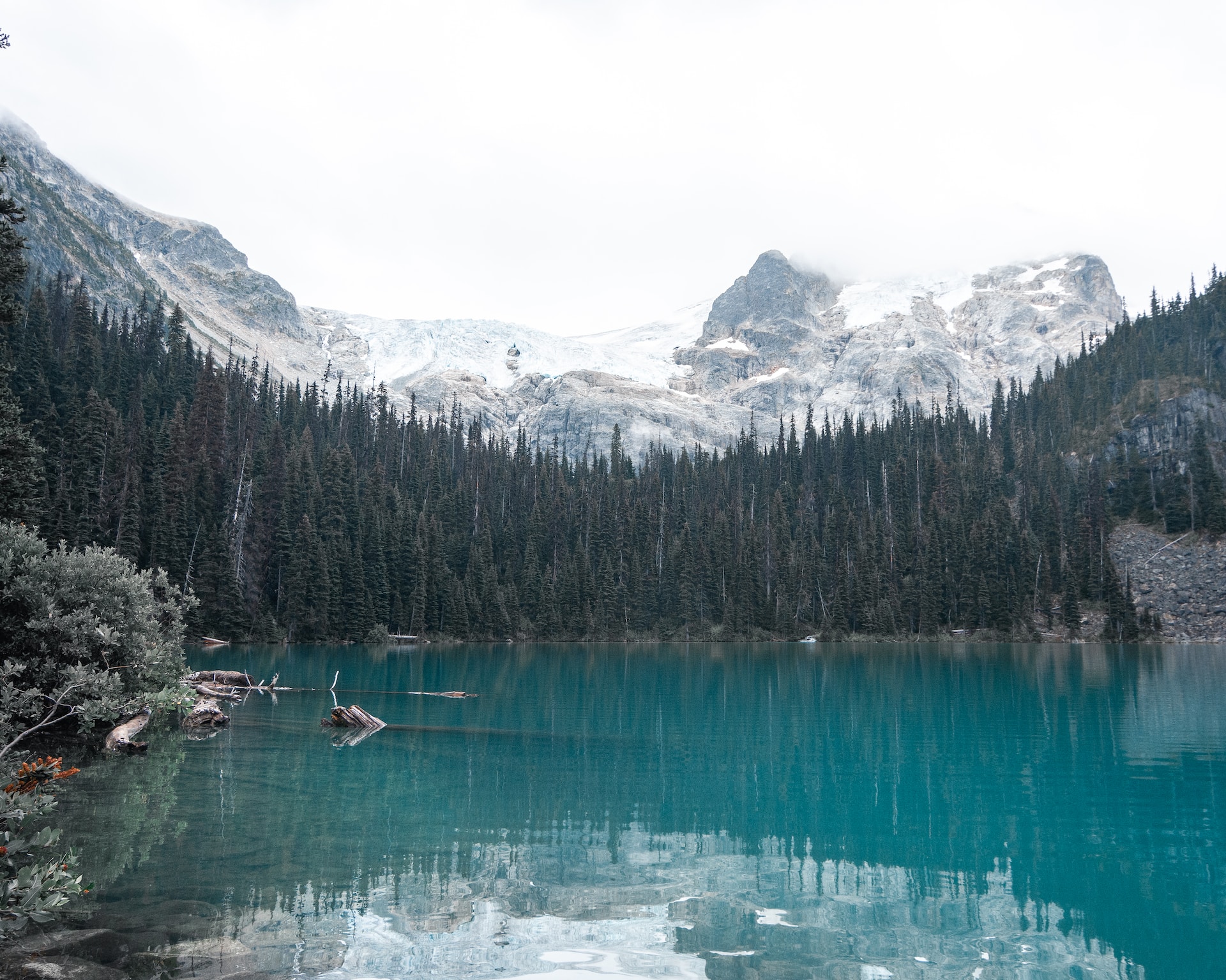
Joffre Lakes
- Location: Joffre Lakes Provincial Park, Pemberton
- Distance: 10 km (6.2 mi) return
- Elevation gain: 350 m (1,148 ft)
- Difficulty: Moderate
The Joffre Lakes Trail is a 10-kilometre (6-mile) trail that leads to three beautiful alpine lakes: Lower Joffre Lake, Middle Joffre Lake, and Upper Joffre Lake. The trail is well-marked and easy to follow, but it does require some elevation gain. The views of the surrounding mountains, including Mount Matier and Mount Garibaldi, are breathtaking.
This hike is one of the most popular in British Columbia, and for good reason. The trail provides a mix of ups and downs, making it challenging but achievable by most hikers as it winds its way through a beautiful old-growth forest before emerging at three stunning turquoise lakes nestled in a glacial valley.
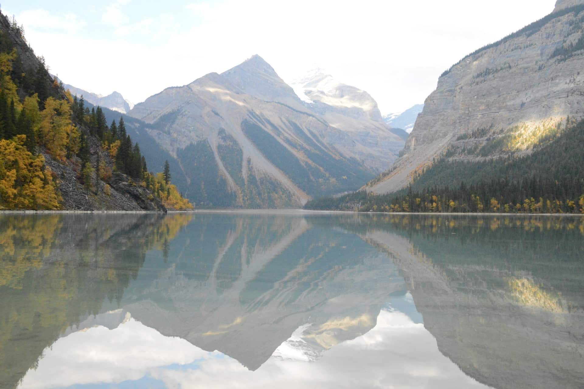
Berg Lake Trail
- Location: Mount Robson Provincial Park, Valemount
- Distance: 23 km (14 mi) return
- Elevation gain: 800 m (2,625 ft)
- Difficulty: Moderate
The Berg Lake Trail is a beautiful and classic hike that takes you to the base of Mount Robson, the highest peak in the Canadian Rockies. So it may come as no surprise that the views at the top are breathtaking. The trail winds its way through a beautiful valley with stunning views of the surrounding mountains and glaciers.
The trail is well-maintained and relatively easy to follow, with plenty of opportunities to see wildlife, including bears, deer, and mountain goats. This trail is suitable for older kids.
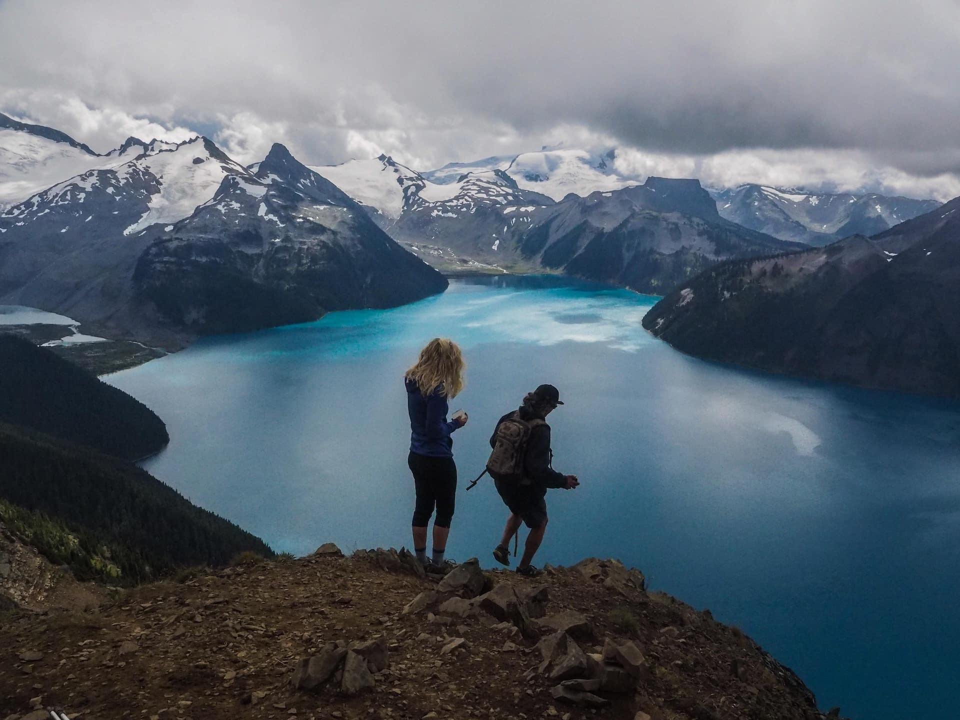
Garibaldi Lake
- Location: Garibaldi Provincial Park, Squamish
- Distance: 18 km (11 mi) return
- Elevation gain: 800 m (2,625 ft)
- Difficulty: Moderate
The Garibaldi Lake Trail is a 18-kilometre (11-mile) trail that leads to Garibaldi Lake, a stunning alpine lake surrounded by snow-capped mountains located in Garibaldi Provincial Park. The trail is well-marked and easy to follow, but it does require some elevation gain. The views of the surrounding mountains, including Black Tusk and Mount Garibaldi, are spectacular.
The lake itself is a popular spot for swimming, canoeing, and fishing, making it a perfect place to spend the day relaxing in nature.
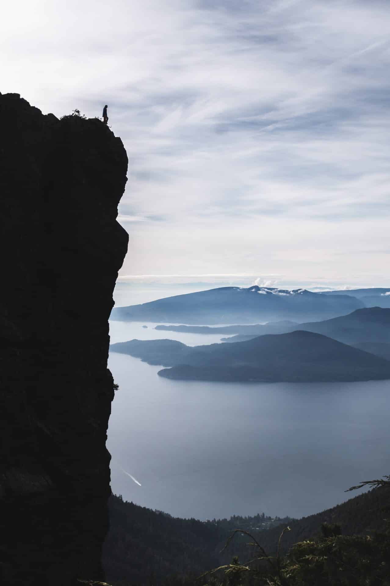
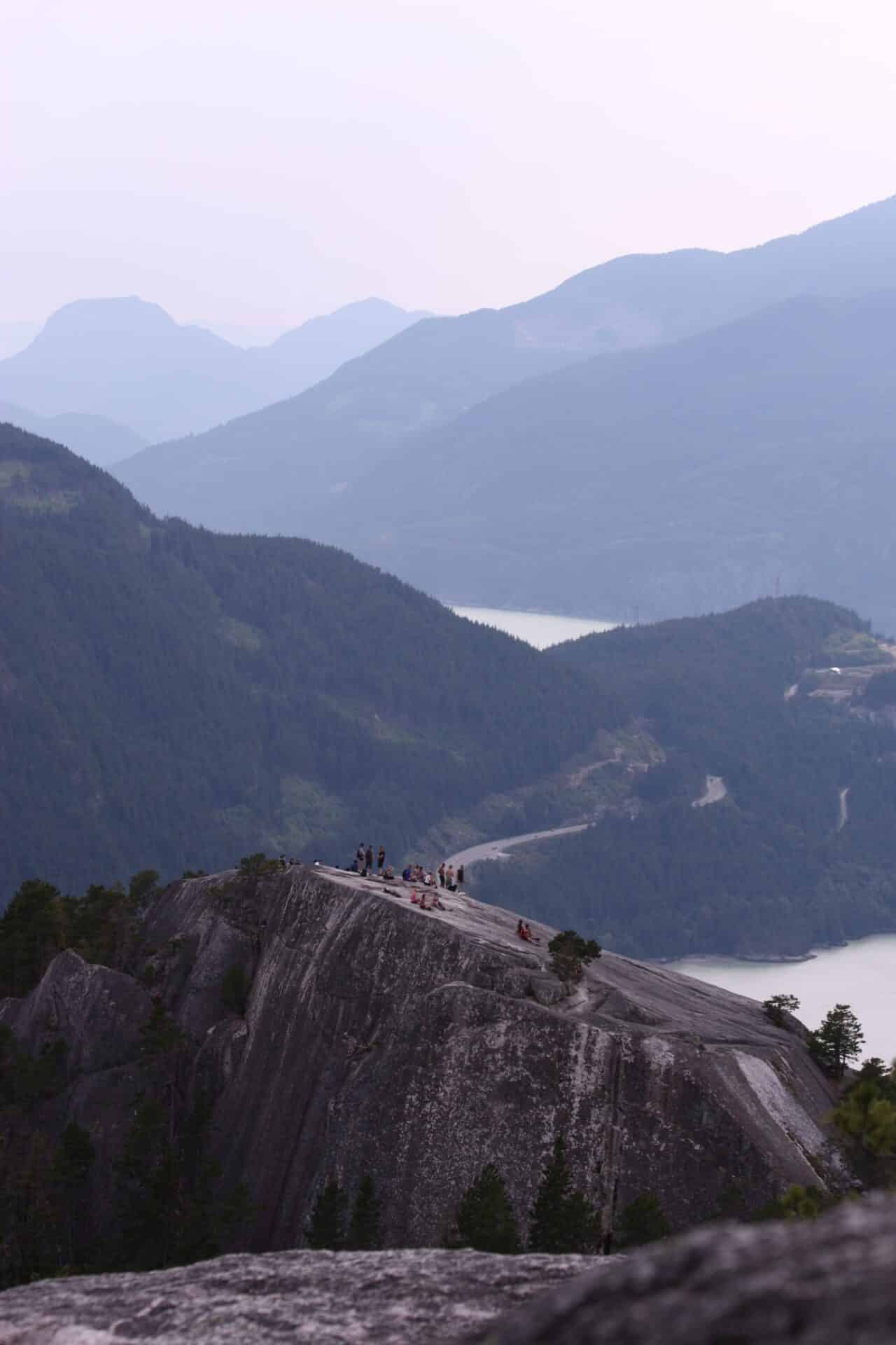
Stawamus Chief
- Location: Squamish
- Distance: 11 km (7 mi) loop
- Elevation gain: 700 m (2,297 ft)
- Difficulty: Challenging
Located just outside of Vancouver, The Chief is a popular hiking destination for locals and tourists alike. This 10-kilometre trail takes you to the summit of The Chief, a massive granite dome that offers panoramic views of Howe Sound and the Coast Mountains. The trail is steep and rocky in places, but the views from the top are simply stunning.
The trail is challenging, but it’s well worth the effort for the amazing views.
The Sunshine Coast Trail
- Location: Sunshine Coast, British Columbia
- Distance: 180 km (112 mi)
- Elevation gain: 5,000 m (16,400 ft)
- Difficulty: Challenging
The Sunshine Coast Trail is a long-distance hiking trail that runs from Sarah Point in the north to Saltery Bay in the south. The trail passes through a variety of landscapes, including forests, mountains, beaches, and inlets.
The trail is divided into 12 sections, each of which can be hiked in a day. The trail offers stunning views of the Coast Mountains, the Pacific Ocean, and the many islands and inlets of the Sunshine Coast. The trail is challenging, but it’s well-marked and there are a number of campsites along the way, making it a great option for a multi-day backpacking trip.
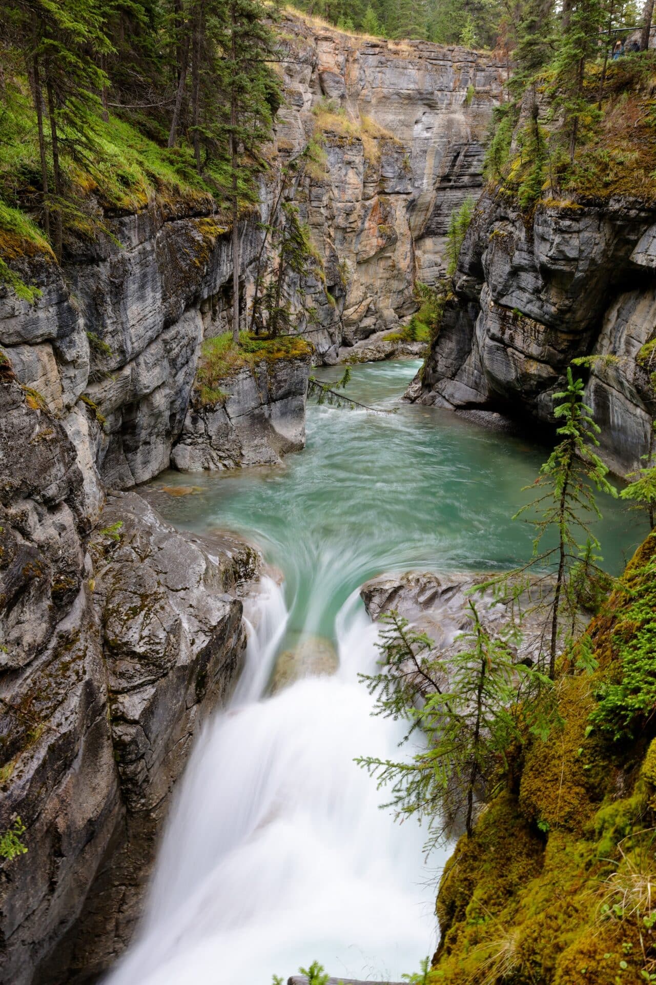
The Maligne Canyon Trail
- Location: Jasper National Park
- Distance: 4.5 kilometers (2.8 miles)
- Elevation Gain: 100 meters
- Difficulty: Easy
This is a short and easy hike that takes you through Maligne Canyon, a deep gorge with waterfalls and limestone cliffs. The trail is well-maintained and suitable for all ages.
The Maligne Canyon Trail takes you along the rim of Maligne Canyon, one of the deepest canyons in the Canadian Rockies. The trail offers stunning views of the canyon and the Maligne River, and it’s a great option for those who want to experience the beauty of Jasper National Park without a strenuous hike.
The Lions
- Location: North of Vancouver
- Distance: 16 kilometers (10 miles)
- Elevation Gain: 1500 meters
- Difficulty: Hard
Another great hike in the Vancouver area is The Lions Trail. It takes you to the summit of The Lions, two prominent peaks that overlook the city. The trail is challenging, with some steep sections and rocky terrain, but the views from the top are simply breathtaking, and you may even see some mountain goats. It is not suitable for young kids.