As a kid, my desert imagination was basically a Sahara screensaver: endless dunes, heat-haze mirages, and a sky so blue it looked aggressive. If there were camels and pyramids, even better. Deserts felt far away—exotic, overseas, and definitely made of sand.
Then I grew up and realized the American West has deserts too… and most of them aren’t dune oceans at all. They are…so much better!
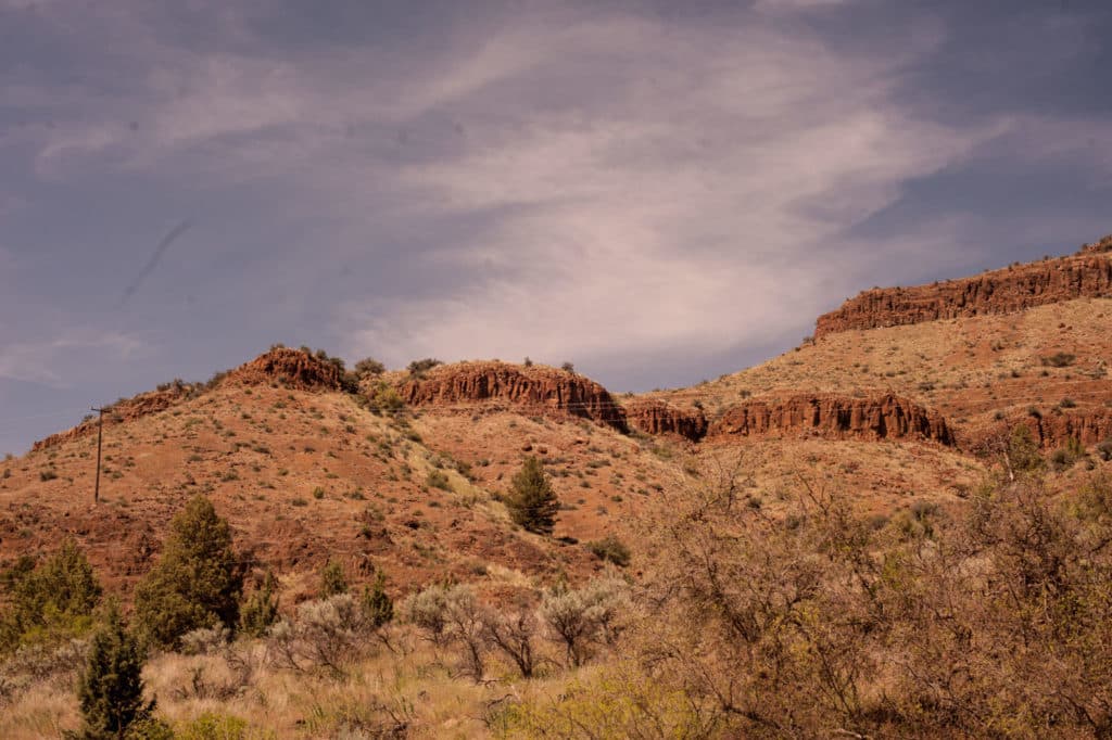
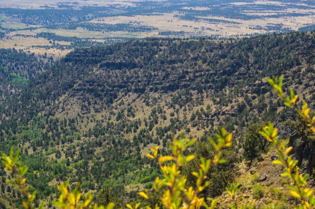
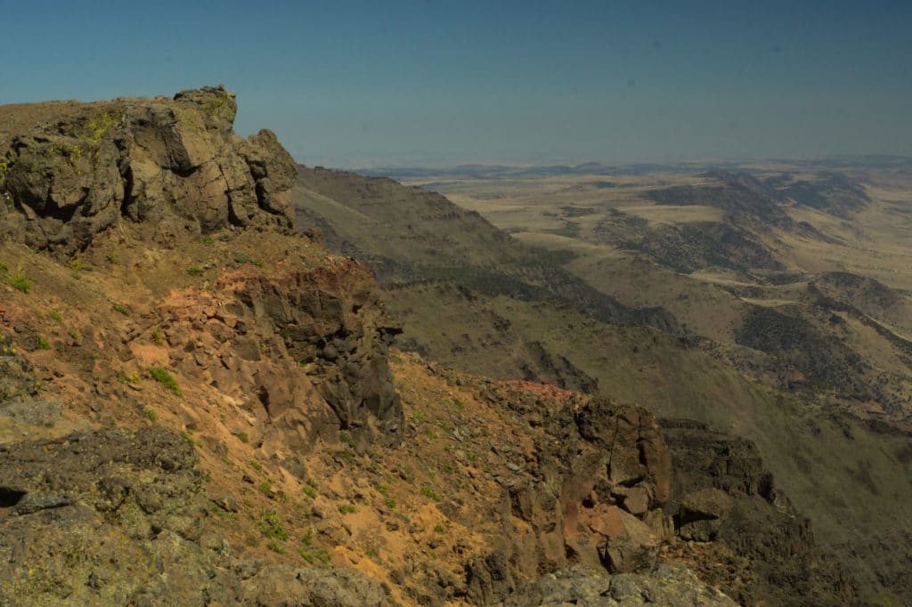
Oregon’s high desert is wide-open and wildly alive—more sagebrush steppe than sand sea, with juniper-dotted hills, basalt cliffs, big-sky sunsets, and pockets of wetlands that attract a ridiculous amount of birdlife. It’s a landscape that looks spare from a distance, then surprises you with texture and detail the longer you linger.
High desert country in Oregon
“High desert” gets used in a few different ways, but in Oregon it generally refers to the high-elevation, semi-arid country east of the Cascades and south of the Blue Mountains—roughly 24,000 square miles of wide-open terrain with relatively low rainfall and an average elevation around 4,000 feet.
This is where you’ll find places like the Painted Hills, the Steens Mountain area, and the Harney Basin’s surprisingly lush wetlands around Malheur National Wildlife Refuge—one of the most important bird habitats in the West.
The drive: Bend to Burns (and why you should take it slow)
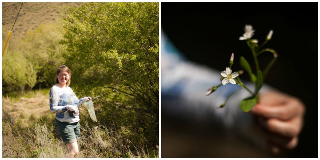
I first headed out here on a mission to collect desert flora and fauna for a biology class—one of those assignments that sounds simple until you’re standing beside a sagebrush flat wondering how something this quiet can feel so enormous.
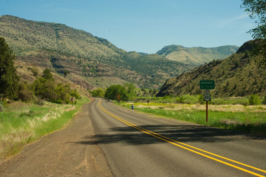
From Bend, you’ll head east on U.S. Highway 20 toward Burns. The drive is about 131 miles and typically takes around 2 hours and change (depending on weather and stops).
And “stops” are the point.
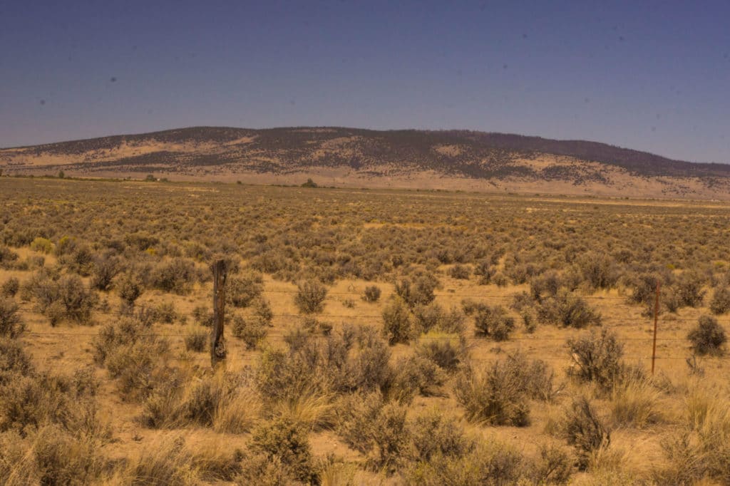
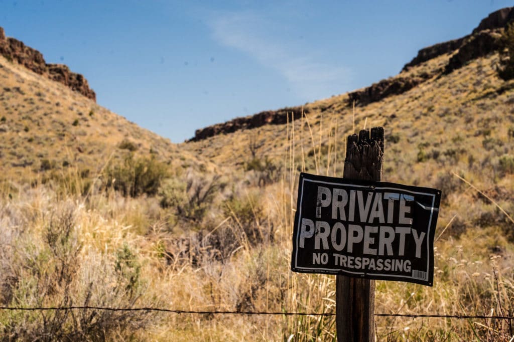
This is serious ranch country—long fences, open range, and big herds moving across a sea of sage. Services are limited, cell signal can be spotty, and you do not want to play gas-station roulette out here. Fill your tank before you leave Bend. (Future-you will be grateful.)
Pull over when you can. Step into the brush for a few minutes and actually meet the high desert up close:
Find a sagebrush bush, rub a few leaves gently between your fingers, then breathe in. That sharp, clean, herbal scent is basically the high desert’s calling card—like nature’s version of “you’re officially out here now.”

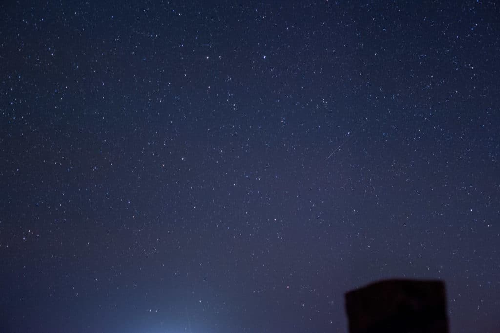
Overnight in Burns, then go star-hunting
Spend the night in Burns, then take a short moonlit walk just outside town.
On clear nights, the sky out here doesn’t just have stars—it has depth. You’ll see constellations you forgot existed, plus that faint milky smear across the sky that makes you stop mid-sentence. It’s the kind of darkness you don’t get in city life, where the night feels like it’s doing its job again.
If you have time: Malheur National Wildlife Refuge
If you’re continuing the adventure the next day, Burns is a great launch point for exploring the Harney Basin—especially Malheur National Wildlife Refuge, which sits roughly 30 miles south of Burns and protects critical habitat for migratory birds and other wildlife.
Even if you’re “not a bird person,” this place has a way of converting people.
Another World (Malheur + Steens)
A few miles south of Burns is where the “high desert” really shows off. Sagebrush flats give way to wetlands, willows, and marshy stretches that feel like a totally different planet than the dry country you just drove through.
Malheur National Wildlife Refuge is the star of the show—one of the most important bird habitats in the West, with hundreds of bird species passing through during migration. It’s the kind of place where you can spot a great blue heron standing perfectly still like a statue… and then, ten minutes later, see something that makes you pull over so fast you nearly drop your coffee (true story: a white pelican cruising low over the road).
A quick historical note, since it still comes up: the refuge headquarters was occupied by armed protesters starting January 2, 2016 (often misremembered as 2015), and the standoff lasted 41 days.
Today, the refuge is open to visitors, with seasonal Visitor Center hours (typically open spring through early fall and closed in winter—always check current hours before you go).
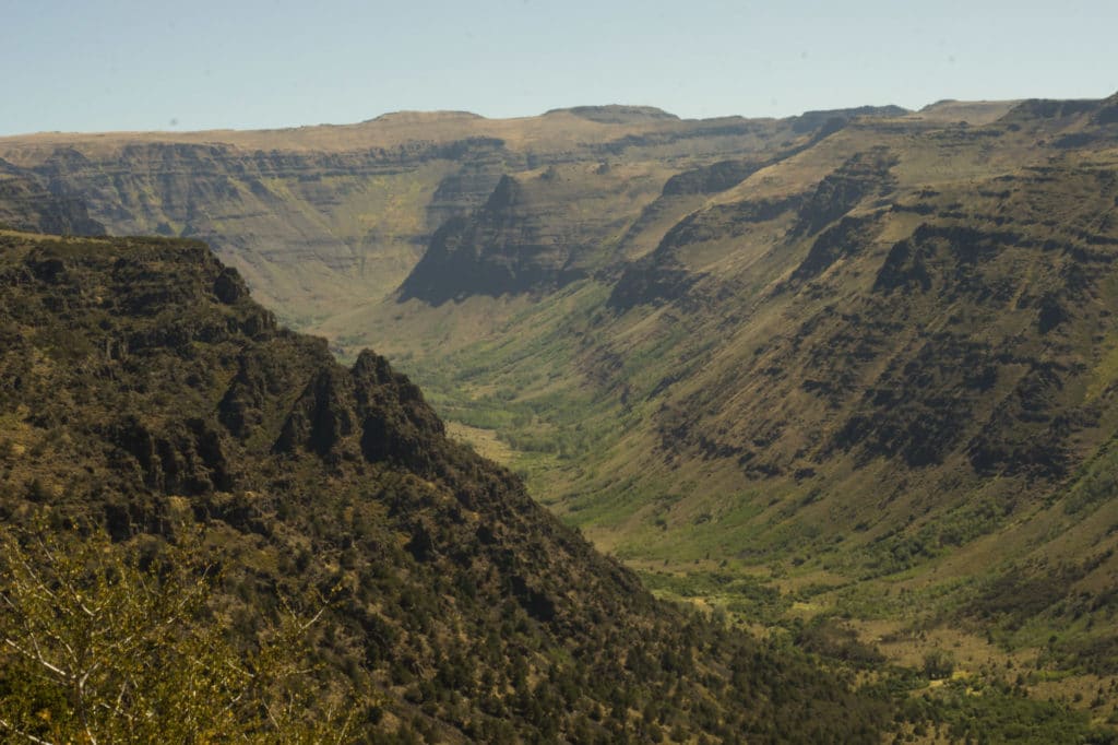
Keep heading south and the landscape gets even more dramatic as you reach the Steens Mountain region—remote, rugged, and big enough to make you feel delightfully small. The Steens Mountain Loop Road (a.k.a. the Steens Mountain Backcountry Byway) climbs from roughly 4,200 to 9,500 feet, and it’s not fully open year-round—gates open/close based on snow conditions.
In other words: even if it’s sunny in Burns, the high elevations can still be very wintery.
If you decide to hike, camp, or drive the loop, plan like you mean it: bring plenty of water, offline maps, a full tank of gas, and whatever you’d want if you had to be self-sufficient for a while. Services out here are limited, and weather can change quickly.
Road note: The loop road is typically a summer-through-fall experience, and in some years there can be partial closures due to rockfall or snowpack. The BLM has noted closures/limited access in past seasons, so it’s smart to check current conditions before you commit.
What to Do in Steens Mountain
1) Malheur National Wildlife Refuge (birding, wildlife, scenic drives)
-
Drive the refuge roads slowly and treat it like a safari. Birds and wildlife show up when you’re not rushing.
-
Stop at the Visitor Center (when open) for the latest wildlife sightings, road conditions, and seasonal tips.
-
Best timing: spring and fall migrations are the big “wow” seasons for birdwatching.
2) Steens Mountain (scenic drive + hikes + overlooks)
-
Steens Mountain Loop Road / Backcountry Byway: one of Oregon’s most epic drives—high elevation, huge views, and that satisfying feeling of being way out there.
-
Seasonality: gates open/close based on snow; summer into early fall is generally the sweet spot.
-
Quick hike add-on: If you base yourself near Frenchglen, Page Springs Campground is also a trailhead for short hikes along the Donner und Blitzen River.
3) If you’re lucky: wild horses
Seeing wild horses out here is unforgettable (and it happens!). If you do spot a herd, enjoy from a respectful distance—this is their home, and you’re the visitor.
Where to Stay Near Steens Mountain
Burns / Hines (easy base for Malheur + supplies)
If you want the most convenience (groceries, gas, quick meals), stay in Burns or neighboring Hines:
-
Best Western Rory & Ryan Inns (Hines) – reliable, comfortable, easy access to Hwy 20.
-
Rory & Ryan Inn (Burns/Hines area) – independent, locally owned option.
-
Historic Central Hotel (Burns) – boutique vibes if you want something memorable instead of purely practical.
Closer to Steens Mountain (for early starts + maximum “remote Oregon” energy)
If Steens is your priority, stay farther south so you can start early and avoid long drives:
-
Frenchglen Hotel (State Heritage Site) – a classic, historic basecamp right at the gateway to Steens.
-
Steens Mountain Wilderness Resort (Frenchglen) – lodging + RV sites + tent sites, open year-round (per the resort).
Hot springs stay (soak + stars)
-
Crane Hot Springs – about 25 miles southeast of Burns, with multiple accommodation styles plus soaking (and top-tier stargazing).
Camping (from easy to remote)
-
Page Springs Campground (BLM) – open year-round, near Frenchglen and the Donner und Blitzen River (great if you want a simple, scenic base).
-
South Steens Campground – generally seasonal (late spring through fall).
-
Winter reality check: the BLM has noted that when winter weather closes the loop road, Page Springs can be the only campground open in the area.
**This post contains affiliate links. When you click through and book any of these properties, I receive a small commission at no additional cost to you. Thanks for supporting Explorer Sue!
Eastern Oregon’s high desert has a way of re-setting your brain—in the best possible way. The skies feel bigger, the roads feel quieter, and every turn seems to reveal another “wait… how is this Oregon?” moment. If you’re ready to see Malheur, Steens, and a few hidden detours without spending hours piecing it all together, I can build you a custom Pacific Northwest itinerary that fits your travel style, timeline, and budget.